
Ficheiro:ScotlandEastLothian.png
Sem resolução maior disponível.
ScotlandEastLothian.png (200 × 230 píxeis, tamanho: 4 kB, tipo MIME: image/png)
|
|
Esta imagem provém do Wikimedia Commons, um acervo de conteúdo livre da Wikimedia Foundation que pode ser utilizado por outros projetos.
|
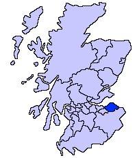
East Lothian unitary council
Slightly edited version of a map drawn by Morwen

|
É concedida permissão para copiar, distribuir e/ou modificar este documento nos termos da Licença de Documentação Livre GNU, versão 1.2 ou qualquer versão posterior publicada pela Free Software Foundation; sem Secções Invariantes, sem textos de Capa e sem textos de Contra-Capa. É incluída uma cópia da licença na secção intitulada GNU Free Documentation License. |
| A utilização deste ficheiro é regulada nos termos da licença Creative Commons - Atribuição-CompartilhaIgual 3.0 Não Adaptada. | ||
| ||
| Esta marca de licenciamento foi adicionada a este ficheiro durante a atualização da licença GFDL. |
Histórico do ficheiro
Clique uma data e hora para ver o ficheiro tal como ele se encontrava nessa altura.
| Data e hora | Miniatura | Dimensões | Utilizador | Comentário | |
|---|---|---|---|---|---|
| atual | 21h33min de 17 de maio de 2005 | | 200 × 230 (4 kB) | Voyager | East Lothian unitary council Slightly edited version of a map drawn by Morwen {{GFDL}} Category:Maps of Scottish unitary councils |
Utilização local do ficheiro
A seguinte página usa este ficheiro:
Utilização global do ficheiro
As seguintes wikis usam este ficheiro:
- ar.wikipedia.org
- ast.wikipedia.org
- be.wikipedia.org
- bg.wikipedia.org
- ca.wikipedia.org
- cy.wikipedia.org
- da.wikipedia.org
- de.wikipedia.org
- en.wikipedia.org
- eu.wikipedia.org
- Ekialdeko Lothian
- Lankide:Euskaldunaa
- Haddington (Eskozia)
- Musselburgh
- Dunbar
- Txantiloi:Ekialdeko Lothian
- Aberlady
- Athelstaneford
- Auldhame eta Scoughall
- Bolton (Ekialdeko Lothian)
- Cockenzie eta Port Seton
- Dirleton
- Drem
- East Linton
- Whitekirk eta Tyninghame
- Wallyford
- East Saltoun eta West Saltoun
- Gifford (Ekialdeko Lothian)
- Gullane
- Wikiproiektu:Irlanda, Gales eta Eskoziako udalerriak
- Ballencrieff (Ekialdeko Lothian)
- North Berwick
- Prestonpans
- Tranent
- Bara (Ekialdeko Lothian)
- Belhaven (Eskozia)
- Biel (Ekialdeko Lothian)
- Bilsdean
- Broxburn (Ekialdeko Lothian)
- Canty Bay
- Carberry (Ekialdeko Lothian)
- Dunglass
- East Fortune
- Elphinstone (Ekialdeko Lothian)
- Garvald (Ekialdeko Lothian)
- Gladsmuir
- Humbie
- Innerwick
- Inveresk
Ver mais utilizações globais deste ficheiro.